
Please note that the text is necessarily provisional because we are awaiting the latest flow figures before confirming the rarity of the current flooding episode. For the latest information on flooding in your area, please visit the Environment Agency website.
UK hydrological summary - 6 January 2014
A vigorous Jet Stream has brought a succession of moisture-laden Atlantic low pressure systems across the UK. Their impact has been exacerbated by high tides and strong winds. Tidal ‘blocking’ of river outflows has been a significant factor in coastal flooding.
Saturated catchment conditions over the last six weeks have meant that even moderate rainfall has increased flood risk, particularly recently when most rivers have been flowing close to bankfull.
 |
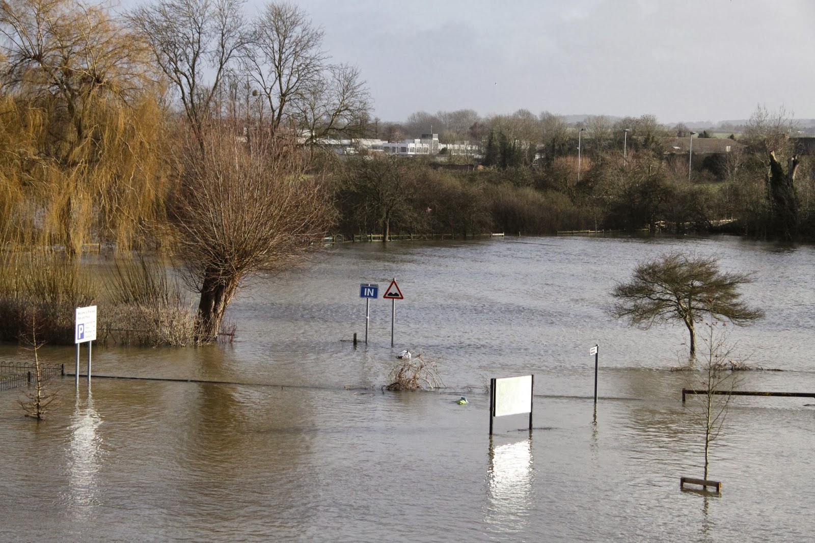
| Flood levels at Wallingford bridge on 9 January 2014 when they were approaching the 2003 marker. Photo: Heather Lowther / Centre for Ecology & Hydrology |
Fluvial flooding has occurred in most river basins across the country and outflow (total river flows) from England & Wales has been exceptionally high - we are awaiting figures but recent daily totals are likely to be the highest since the late 2000 floods (and possibly amongst the highest since 1947).
However, whilst floodplain inundations have been extensive and sustained, extreme flow events in individual rivers have been relatively uncommon (the relatively even distribution of the rainfall and the speed of passage of the low pressure systems are key factors in this spatial distribution).
Flood defences have generally performed well. Most flooding of property, to date, has been on sites constructed on floodplains or low-lying coastal locations. The most damaging flooding is normally local or regional in extent (the summer floods of 2007 in Yorkshire and South/Central England and the July/Sept floods of 1968) being examples of regional flooding. Recent weeks are most notable for the wide areal extent of notably high flows rather than record runoff in individual rivers.
 |
| Floodplain inundations have been extensive. Photo: Paulette Burns / Centre for Ecology & Hydrology |
None of the flooding in the last 50 years matches that experienced in March 1947 when a warm front brought moderate rainfall and a rapid increase in temperature which melted snow accumulations of >30cm across much of England & Wales. At that time, flood defences were rudimentary. Such floods are less likely to occur in a warming world and, although the frequency of high flows has increased in the last 50 years, there is no compelling long-term trend in annual maximum flows for UK rivers.
However, with sea levels rising (exacerbated by isostatic re-adjustment in some regions), the type of fluvial/tidal flooding recently experienced may be expected more frequently in the future.
With regard to the UK’s Water resources (which supply water for household and industrial use) the rainfall in December and early January has ensured that reservoir stocks are above average across almost all of the UK and groundwater levels have generally risen rapidly over the last six weeks. The water resources outlook for 2014 is therefore very healthy.
Terry Marsh, Centre for Ecology & Hydrology, 6 January 2014
Additional information
Key floods publications from CEH
Report - The 2010-12 drought and subsequent extensive flooding [PDF]
The section from pages 44-47 covers recent decades in the context of long-term trends for rainfall, runoff (river flows) and groundwater levels.
Report - The Summer 2007 floods in England and Wales [PDF]
Report - The 2000/2001 floods
Briefing Note - Understanding Floods [PDF]
Related links
CEH Blog: Rainfall, UK floods and the potential impacts of climate change?
Flickr: Photos of January 2014 flooding in Wallingford, Oxfordshire
*The National Hydrological Monitoring Programme (NHMP) aims to provide an authoritative voice on hydrological conditions throughout the UK, to place them in a historical context and, over time, identify and interpret any emerging hydrological trends. Such information is essential for improved water management strategies and its dissemination helps to increase public understanding of hydrological and water resources issues.
This is accomplished through regular monthly and annual bulletins, occasional reports on floods and droughts, and engagement with the media. Hydrological analysis and interpretation within the programme is based on the data holdings of the National River Flow Archive and National Groundwater Level Archive, including rainfall, river flows, borehole levels, and reservoir stocks.
The NHMP is run with the cooperation of the principal Measuring Authorities of the Environment Agency (England), Natural Resources Wales, the Scottish Environmental Protection Agency, and the Rivers Agency (Northern Ireland).
Amongst the NHMP outputs are:
- Hydrological Summary for the UK (monthly reports)
- Hydrological Review of the Year (annual report)
- Analyses and assessments of hydrological events (occasional reports)
NB: This post was edited on 9 January 2014 to include a new photograph of the flood level mark at Wallingford Bridge. All photos indicating the rising flood levels are available on our Flickr set.
No comments:
Post a Comment