Showing posts with label river flows. Show all posts

Thursday, 12 March 2015

Retirement beckons for voice of UK hydrological reporting

As many of our regular readers will know, the UK hydrological summary is a monthly update from scientists within the Centre for Ecology & Hydrology working with colleagues from the British Geological Survey. Every month, under the National Hydrological Monitoring Programme, they collate, quality check and analyse various data with regard to river flows, reservoirs and groundwater, placing them in historical context and identifying hydrological trends. The team produces regular updates and occasional reports into events such as the summer floods of 2007 and the recent 2010-2012 drought to flood transformation.

For several decades, a mainstay of the NHMP has been our own Terry Marsh, leader of the programme since 1982. This month, March 2015, is Terry's last before retirement so it is fitting that he authored the summary issued this month (analysing water resources in February 2015), bringing the total he has authored to an incredible 286. This "special souvenir edition" contains a tribute to Terry from his colleagues.

So, download the latest summary (PDF) and, after taking in the assessment of the UK's hydrological conditions, browse to page 3 for a tribute to Terry Marsh, the eloquent voice of UK hydrological reporting over the last three decades. As Terry is always one for a turn of phrase, it is certainly an appropriately written tribute. Although as colleagues note, it’s perhaps ironic that Terry signs off with a month notable for its normality!

A word cloud based on hydrological summaries authored by Terry Marsh

Related links


Staff page of Terry Marsh, CEH

National Hydrological Monitoring Programme

Hydrological Summaries of the UK

Blog posts relating to the National Hydrological Monitoring Programme

Wednesday, 26 November 2014

Helping to restore India’s rivers

Scientists from the UK’s Centre for Ecology & Hydrology (CEH) were in India recently (10-14 November 2014) to participate in intensive discussions with researchers from the National Institute of Hydrology in Roorkee relating to work to restore India's rivers. Mike Acreman, Cedric Laize, Harry Dixon and Nathan Rickards of CEH gave a number of presentations and took part in knowledge exchange discussions with Indian counterparts led by Dr Sharad Jain to explore how CEH expertise can help develop the scientific capacity and strengthen the local skills needed to carry out such research.

Ganges near Haridwar. Photo: Mike Acreman
The health of India’s rivers is a critical issue. Water is essential for the future well-being of the people of India and the country’s economy. Past water management has focused largely on flood protection and on delivering water for irrigated agriculture, domestic supply and hydropower generation. Stress on water resources will increase as India’s population is expected to rise from the current 1.21 billion (2011 census) to 1.6 billion by 2050.

Historically water has been supplied from major rivers. The largest and most iconic Indian river is the Ganges, which is also considered sacred by the Hindus that make up 80% of the Indian population. Despite this the Ganges has become depleted of water and highly polluted by raw sewage and industrial waste leading to loss of species, such as the river dolphin, and making it unsuitable for religious uses. The Government of India is now preparing plans to clean the rivers, beginning with the River Ganges and the Prime Minister, Narendra Modi, has announced funding for the Namami Ganga project of 20 billion Rupees (£0.2 billion). Restoring appropriate flows to the river will be essential to bringing the rivers back to life alongside reducing pollution.

Gauging station on the river Ganges. Photo: Mike Acreman
CEH is supporting the Indian National Institute of Hydrology to produce computer models of the Ganges and other rivers to understand the implications of allocating water to different uses and to define the flows needed to achieve levels of river health. CEH project leader Prof Mike Acreman told us that “restoring the Ganges and other Indian rivers to good health will take a long time, but we hope that the enthusiasm and local knowledge of Indian water scientists supported by CEH’s vast global research experience will help the Indian government achieve its aim”.
 

Additional information


Staff page of Prof Mike Acreman

Staff page of Cedric Laize

Staff page of Dr Harry Dixon

CEH's Science Areas

Monday, 6 October 2014

Solar dimming and river flows - background to new paper

A new Met Office-led paper has just been published in the journal Nature Geoscience, entitled “Detection of solar dimming and brightening effects on Northern Hemisphere river flow” by Nic Gedney et al.

Chris Huntingford, who is a co-author, writes:

“In any debate surrounding large-scale environmental change, invariably there is discussion as to the effect of increasing levels of atmospheric greenhouse gases. This is particularly in terms of temperature change, and much attention has been placed on fusing together models and data to identify whether there is a human influence on the climate system. Such analysis (often called “detection and attribution”) does suggest that to a high level of confidence, fossil fuel burning has altered the climatic state by increasing atmospheric concentrations of gases such as carbon dioxide. However these analyses of temperature measurements also confirm that an atmospheric aerosol signal is present. The raised level of such particulates, regionally at least, has a partial cooling offset of global warming. Additionally higher aerosol concentrations are known to reduce the amount of the Sun’s light and energy reaching the Earth’s surface.

In this study we accept that both raised greenhouse gas concentrations and aerosols alter meteorological conditions (via temperature levels and indirectly rainfall), which in turn will influence river flows. However to confirm the presence of any aerosol signal, here we instead focus specifically on the impact of changes in sunlight and energy reaching the land surface, and on implications for observed river flows in multiple basins in Northern Hemisphere industrialised areas. This is through the so-called “dimming” and subsequent “brightening” period, the latter a consequence of clean-air acts in many regions.

In our study, we find that when we use a river runoff model, forced with and without estimates of aerosol-induced changes in surface shortwave radiation (i.e. surface energy), then we can only fully explain the river flow data once the aerosol effect is included. Lower surface energy tends to enhance river flows to levels higher than they might otherwise have been. This is because this suppresses water loss by evaporation across the land surface. We can see this effect over Central Europe, in the periods of major solar dimming.

A major focus on climate change will always remain as characterising changes in surface temperature. However to additionally observe and explain anthropogenic influences in a key impact such as river flows does raise confidence in ability to model our changing environment. Such confidence is required, in order to then be able to rely on future computer-based projections and the role they may play in underpinning future policy on the global environment.”

The paper authors are from the Met Office, Centre for Ecology & Hydrology, University of Reading, Laboratoire de Météorologie Dynamique in France, and the University of Exeter.

Chris Huntingford is a Climate Modeller at the Centre for Ecology & Hydrology.

Additional information


Air pollution increases river flows - CEH news story

Paper details:

Detection of solar dimming and brightening effects on Northern Hemisphere river flow.
Gedney, N., Huntingford, C., Weedon, G.P., Bellouin, N., Boucher, O. and Cox, P.M. (2014), Nature Geoscience, doi: 10.1038/NGEO2263

Staff page of Dr Chris Huntingford, CEH

Thursday, 11 September 2014

Potential influences on the United Kingdom's floods of winter 2013/14

Last winter severe flooding affected large parts of the UK. In a recent paper published in Nature Climate Change, scientists at the Centre for Ecology & Hydrology, working with colleagues from the Met Office and a number of universities, looked at the possible drivers behind the floods.

Dr Chris Huntingford, the lead author of the paper, explains:

In this paper, along with my co-authors, we have tried to provide a summary document that collates and discusses all possible drivers behind the major flood events that affected the UK last winter. It has three themes.

First, a very brief overview of the large-scale meteorological events leading up to the storms is presented. None of the individual rainfall events was unprecedented, but the weather patterns behind them persisted for three months causing a near-continuous succession of Westerly storms. This had the cumulative effect that for much of the Southern UK, the total winter rainfall was record-breaking. Preliminary analysis suggests that particularly warm ocean conditions and heavy rainfall in and around Indonesia triggered wind patterns across the Pacific that travelled northwards before ultimately drawing cold air down across the USA. This in turn forced a particularly strong and persistent Jet Stream across the Atlantic and towards the UK. The Met Office is now studying this sequence of events in significantly more detail. In our paper, we show how the winter storms affected river flows, and place the events within a historical context.

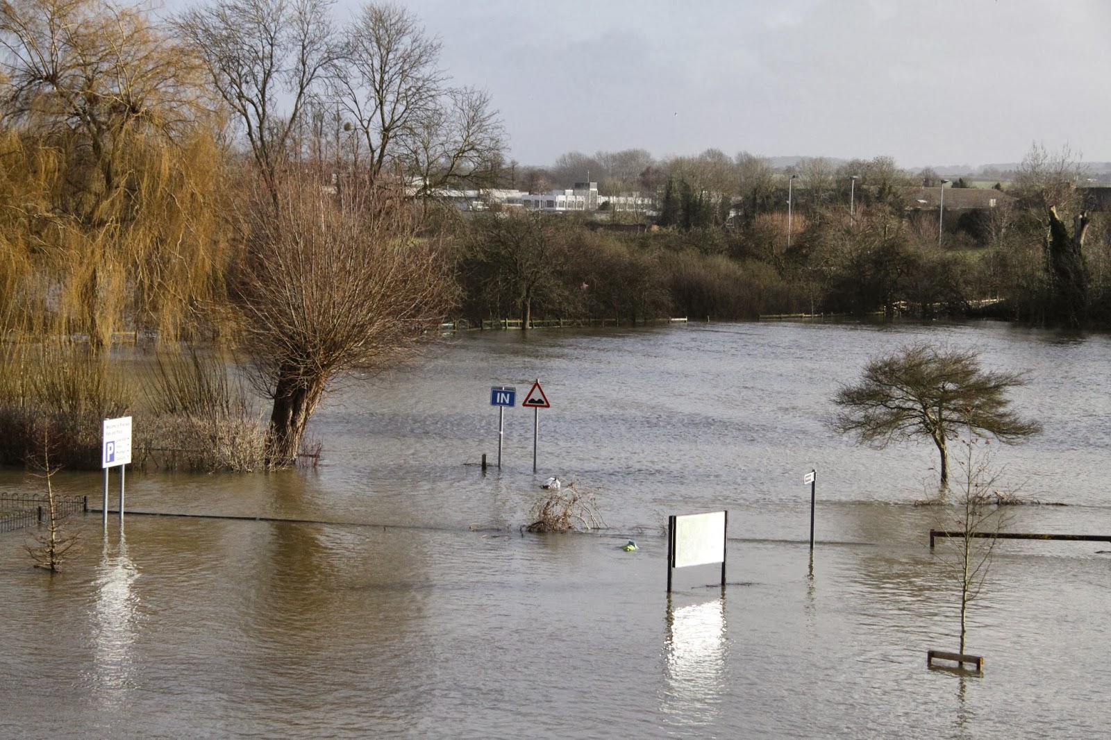
Flooding in Oxfordshire, February 2014. Photo: Julia Lawrence

Second, questions mount as to whether fossil fuel burning could have a role. We have reviewed existing research literature for Earth system factors that may be both changing through global warming, and additionally are identified as influences on storm features for the UK. As expected, this confirms how complex and inter connected the climate system is. Multiple possible UK rainfall drivers are identified that link to the state of the oceans, the atmosphere and sea-ice extent. Interestingly the recent rapid decrease in Arctic sea-ice that is widely attributed to global warming, for the UK at least is often portrayed as likely to bring more Easterly winds and colder conditions. The previous three winters had these features for some of the time, in marked contrast to winter 2013/14. Although the precise details of linkages between changing large-scale features of the climate system and UK rainfall intensity are still not fully understood, we hope our review article is a complete list of such connections. To apply that frequently used expression, we trust there are no “unknown unknowns” lurking out there we have yet to consider.

Third, we provide some thoughts on how best to proceed. Assuming that we do have a pretty good idea of all drivers expected to affect rainfall, and that require on-going computer modelling, three challenges are noted. These are: (1) the need for continued enhancement of physical process representation via ever better parameterized differential equations of the oceans, atmosphere and ice sheets, (2) increase further the numerical grid resolution of climate models, on which these equations are calculated and (3) undertake significantly higher numbers of simulations, all with slightly different initial conditions, creating a large ensemble of projections. The call for better resolution is because some characteristics of storms occur on fine spatial detail, thus needing small spacings between gridpoints on which calculations are updated. The request for large ensembles is because extremes, by definition, are rare events, and so we need to ensure that all heavy rainfall “return times” are fully sampled. This is both for pre-industrial and for raised levels of atmospheric greenhouse gases.

During the major flood events affecting much of Southern England from December 2013 to February 2014, it was inevitable that questions would be asked as to whether fossil burning could have a role. It is always (and correctly) stated that no single observed extreme event can be formally attributed to human-induced changes to atmospheric composition. But a statistic can be derived that assesses any changing probability of a particular extreme event occurring, a quantity sometimes referred to as “Fractional Attributable Risk”. By satisfying the three challenges we listed above, we will get near to stating if humans are increasing, decreasing or leaving invariant the chances of rainfall events of the type witnessed. However, even now limitations remain on computer speed and resource, and expenditure on climate research can only ever be finite. Hence an especially lively debate will now occur as to what constitutes the optimal balance between pursuing these three challenges, in order to get us most quickly towards the required answers.

Anyone studying meteorological systems, or the full Earth system, soon realizes of course how tightly coupled all features are of the climate system. In this review, by trying to collate in to a single paper the main factors affecting UK rainfall, this did though provide a timely reminder of such comprehensive interconnections. Understanding these further suggests a very interesting time lies ahead for climate change research.

Chris Huntingford

Chris Huntingford is a climate modeller based at the Centre for Ecology & Hydrology in Wallingford, Oxfordshire.

Additional information


Full paper reference: Chris Huntingford, Terry Marsh, Adam A. Scaife, Elizabeth J. Kendon, Jamie Hannaford, Alison L. Kay, Mike Lockwood, Christel Prudhomme, Nick S. Reynard, Simon Parry, Jason A. Lowe, James A. Screen, Helen C. Ward, Malcolm Roberts, Peter A. Stott, Vicky A. Bell, Mark Bailey, Alan Jenkins, Tim Legg, Friederike E. L. Otto, Neil Massey, Nathalie Schaller, Julia Slingo and Myles R. Allen (2014) Potential influences on the United Kingdom’s floods of winter 2013/14. Nature Climate Change, doi:10.1038/NCLIMATE2314

Staff page and research interests of Chris Huntingford 

New scientific review investigates potential influences on recent UK winter floods  (CEH News, 27 August 2014)

Wednesday, 30 April 2014

CEH science at EGU2014

The breadth of CEH science has been well represented in several sessions at this week’s European Geosciences Union General Assembly 2014 in Vienna. The event brought together more than 11,000 scientists from all over the world into one meeting covering all disciplines of the Earth, planetary and space sciences. Check out our Storify for a flavour of what’s been going on for CEH or scroll down for abstracts of our lead talks and posters.


Abstracts


Stephen Thackeray presented an update on the Shifting Seasons and climate change phenology project which he leads. For more details of the project, visit the webpage.

Andrew Chiverton: Which catchment characteristics control the temporal dependence structure of daily river flows?

Kelly Mason: Regulation of Boreal soil respiration - evidence from a Swedish forest fire chronosequence

Ed Rowe: Towards an understanding of feedbacks between plant productivity, acidity and dissolved organic matter

James Miller: Assessing the relative and cumulative impacts of future urbanisation and climate change on storm runoff in a peri-urban catchment

Steven Cole: Probabilistic flood forecasting for Rapid Response Catchments using a countrywide distributed hydrological mode

Kerry Dinsmore: Aquatic carbon and GHG losses via the aquatic pathway in an Arctic catchment

Cecilia Svensson: Improving winter river flow forecasts for the UK

Andy Robertson: Land use change to Miscanthus - measured and modelled changes in soil carbon fractions

Carole Helfter: Effects of winter temperature and summer drought on net ecosystem exchange of CO2 in a temperate peatland

Andy Robertson: Using an input manipulation experiment to partition greenhouse gas fluxes from a commercial Miscanthus plantation in the UK

Cecilia Svensson: Seasonal UK river flow forecasts based on persistence and historical analogy

Jessica Adams: Estimating sources and fluxes of dissolved and particulate organic matter in UK rivers

Kerry Dinsmore: Multisite comparison of drivers of methane emissions from wetlands in the European Arctic - influence of vegetation community and water table

Garry Hayman: Wetland methane modelling over the Scandinavian Arctic - performance of current land-surface models

Additionally, our scientists have been busy collaborating with many international colleagues who also gave talks at the event: topics included the Globolakes project, atmospheric ammonia, emissions modelling at the field scale, monitoring changes in peatland, greenhouse gas production from shallow lakes and ponds, soil organic carbon dynamics, vulnerability of ecosystems to extreme climatic events, water quality sampling, streamwater nitrate dynamics, soil status in drought, crowd-sourcing data with the mySoil app, historical flood information, using isotopes in Arctic catchments, the sensitivity of river reaches to water abstraction, soil hydraulics, peatland modelling, microbial carbon turnover and hazard assessment for volcanic eruptions.

Kelly Mason, Research Associate in Plant-Soil Interactions at CEH, presented
work on regulation of boreal soil respiration, which was carried out with
colleagues from CEH, Lancaster University, University of Washington and Bangor
University. Photo: Andy Robertson


Posted by Paulette Burns

Thursday, 13 February 2014

Scientists from CEH comment on the ongoing flooding situation in the UK - 13 February 2014

Scientists from the Centre for Ecology & Hydrology have provided the following new comments on the ongoing storms and flooding situation in the UK.

You can read our previous comments (published on the 11 February 2014) here.

Prof Richard Harding,  Centre for Ecology & Hydrology, on the December/January/February floods

"The weather in the last two months has been exceptional. It has been characterised by frequent rain systems tracking across the south of Britain, often associated with high winds. In January the rainfall totals were locally 300% above average and over 200% over a large part of southern England. The result of this relentless rainfall has been that soils and underlying aquifers are now full and the rivers and wetlands have more water flowing through them than has been observed for many decades.
"The repeated passage of storms over England has been caused by a persistent Jet stream to the south of its usual position. This persistence may be linked to the reduction of sea ice in the Arctic or warm sub-tropical sea temperatures. We have observed in the last five decades a rise in temperatures and an increase in the amount of water vapour in the atmosphere – these almost inevitably lead to an intensification of storms and increases in rainfall. Indeed we have observed an increase in the intensity of rainfall in this period. The last two decades have also brought exceptional extremes in our rivers and groundwater– with floods in 2000/01, 2002/3, 2007, 20011/12 and now 2013/14 interspersed with droughts in 2003 and 2011/12. All these trends are entirely consistent with the effects of increasing CO2 in the atmosphere.
"In the short term the saturated nature of the ground means that rivers and low lying areas are very vulnerable to flooding. In the longer term this exceptional weather and extensive floods highlights that we are going to have to adapt to much more variability and extremes in the future."

Mr Nick Reynard, Science Area Lead for Natural Hazards, Centre for Ecology & Hydrology

"After the devastating summer floods of 2007 the Pitt Review carefully analysed all aspects of how this country prepares for and deals with flooding. Post Pitt there have been two key developments in the implementation of flood forecasting science to better predict both the risks and impact of flood events. The first is the development of the Flood Forecasting Centre, which combines meteorological and hydrological expertise to provide forecasts for all natural forms of flooding - river, surface water, tidal/coastal and groundwater. River flow forecasting is underpinned by the Grid 2 Grid model developed by the Centre for Ecology & Hydrology.
The second significant development has been an increased focus on surface water flooding - many of the 55,000 homes affected in 2007 were flooded by a surface water event. Surface water flooding is a key focus of the recently formed Natural Hazards Partnership, which provides information, advice and analysis to government and emergency responders across the UK in the preparation, response and review of natural hazards. and brings together expertise from across the UK's leading public sector agencies and research institutes."

Mr Terry Marsh, Leader of the National Hydrological Monitoring Programme, Centre for Ecology & Hydrology

"The tempestuous weather affecting the UK has continued through the first two weeks of February 2014. It appears likely that winter rainfall totals across much of Southern Britain will be the highest on record (in the NCIC series from 1910). As a result river flows have continued to increase in parts of the country, most notably in the Thames and the Severn basins. In recent days on the Thames river flows are approaching or have exceeded maxima recorded in the last major event (November 1974). The high river flows have led to extensive floodplain inundations aggravated by groundwater flooding in many vulnerable parts of the catchment."

Tuesday, 11 February 2014

Scientists from CEH and BGS comment on the ongoing flooding situation in the UK - 11 February 2014

Scientists from the Centre for Ecology & Hydrology and their NERC colleagues in the British Geological Survey have provided the following comments on the ongoing storms and flooding situation in the UK.

We published further comments on 13 February 2014. Read them here.


Mr Terry Marsh, Leader of the National Hydrological Monitoring Programme, Centre for Ecology & Hydrology

"One of the issues for the public perception to take on board is what we are currently seeing is the Thames exercising its natural sovereignty over its floodplain. This happens occasionally and in a sense it’s good for people to recognise that this happens. Management needs to limit the damage but it would be, I suggest, even worse if we found ourselves in the position where people thought because we’ve not seen this extent of flooding for 40 years that it’s not going to happen. It’s a natural part of the way rainfall patterns translate into river flow patterns."

Dr David Boorman, Science Area Lead for Water Resources, Centre for Ecology & Hydrology

"A key question in any unusual hydrological situation, such as a drought or a period of wet weather as we are experiencing now, is how long will it continue? We are working with a number of partners to provide a long-range hydrological forecast for the UK. Forecasts of this type are already produced on an operational basis in a number of countries including the USA and Australia.

“The project involves bringing together information on the current weather, soil moisture, river flows and groundwater levels from across the UK, and using a number of methods of exploring possible future hydrological conditions, for example, using numerical models of river flows and groundwater models driven by long-range weather outlooks."

Mr Nick Reynard, Science Area Lead for Natural Hazards, Centre for Ecology & Hydrology

"The cluster of drought and flood events through the early years of the 21st century and the recent runoff and recharge patterns, are near to the extreme range of historical variability as we currently understand it , and therefore also raise the question that they may reflect anthropogenic climate change. It is important to note, however that how river flows respond to extreme rainfall varies greatly because of geology, soils, land use etc, meaning that it is difficult to detect signals of climate change in observed events, and to generalise the impacts of climate change for future flooding. Tidal flood risk is increasing as sea levels rise but the outlook is more complex in relation to fluvial flooding."

Prof Alan Jenkins, Director of Water and Pollution Science, Centre for Ecology & Hydrology

"The long duration of the current flooding episode and its wide spatial extent make it an exceptional event. Relentless storm events over many weeks have combined to produce widespread flooding at a scale rarely seen in the UK. Over 5000 homes have flooded and transport infrastructure has been disrupted across the UK.

“The key to mitigating the impact of any flood is understanding that every catchment works in a different way. For example the current flood situation on the Somerset Levels is the result of a different range of processes to those currently affecting the lower reaches of the River Thames. The operational agencies are doing a sterling job on the ground and it’s important to recognise that hundreds of thousands of homes have been protected by the UK’s flood defence infrastructure.

“Many potential solutions have been talked about over the last few weeks as ways of minimising flood risk. This is a complex issue and over the next few months it is important that experts from the key agencies and research institutes sit down and carefully analyse whether there are lessons to be learnt from the current flood episode."

Dr Chris Huntingford, Climate Modeller, Centre for Ecology & Hydrology

"In terms of climate change, there is a desperate need to move away from the almost Punch-and-Judy debate of either every extreme is due to climate change, or the contrast of everything is simply natural variability. Desperately needed is the on-going calculation of whether higher atmospheric concentrations of carbon dioxide are changing the chances of rainfall events, as recently witnessed, occurring.

To work this out, weather forecast models that analyse the atmosphere in such fine detail as to model storm tracks, need to be operated for different levels of modelled carbon dioxide. Running these for hundreds of modelled years for alternative carbon dioxide concentrations, so as to build up statistical profiles of rainfall patterns, presents one of the biggest computational challenges ever tackled."

Mr Simon Parry, Hydrologist, Centre for Ecology & Hydrology

"Each one of these individual events has not been particularly outstanding, they've been broadly along the lines of what we would expect for a typical winter storm in the UK. What's been notable about it, and different from what we've seen in the past, is the persistence. The combination of high tides, strong winds and a succession of rain-bearing low pressure systems has led to widespread and sustained high flow conditions over a two month timeframe."

Mr Andrew McKenzie, Groundwater Information Manager, British Geological Survey

"In early December 2013 groundwater levels over much of the UK were normal for the time of year. The extreme rainfall in the southern part of England over the New Year and into early January had a dramatic impact on levels in the faster responding aquifers and spectacular rises occurred in groundwater levels in some aquifers. For example, groundwater levels in the Chalk at Tilshead on Salisbury Plain rose by about 20 metres in just two weeks. These rapid rises triggered some localised groundwater flooding, mainly in the upper parts of Chalk catchments. If rainfall had eased at that point the empty storage in the lower catchment might have been able to absorb the inflows. However, as rainfall has continued to fall the lower parts of many catchments have been saturated, and prolonged high river levels will have contributed to exceptional recharge.

“At the beginning of February record monthly groundwater levels were measured across many aquifers, and as levels in February are naturally high, these records are often all time records for the sites concerned. Record levels were established in the Chalk of Wessex, the North Downs and Hampshire. The wet weather also reversed a declining trend in some of the North West Permo-Triassic aquifers.

“Consequently, emergence of groundwater has been observed at many localities across southern England where groundwater flooding has been previously recorded. The high water levels on the interfluves (the upper parts of groundwater catchments) will gradually feed into the lower parts of the catchments, over a period of weeks to months, so groundwater flooding is expected to persist."

Additional information


Journalists can contact the CEH Press Office or the BGS Press Office for further context on the UK's hydrological situation. 

Further information from CEH can be found in the following blog posts:

Record breakers? Climate change, statistics and the recent UK floods - 9 February 2014

Rainfall, UK floods and the potential impacts of climate change? - 6 January 2014

CEH worked with the Met Office on a report on the recent storms and floods in the UK.

Sunday, 9 February 2014

Record breakers? Climate change, statistics and the recent UK floods

This morning the Met Office and the Centre for Ecology & Hydrology released a report on the recent storms and floods in the UK.

You can read the full report here, and a short summary of the hydrological analysis on our website here

The report documents the recent record-breaking weather and flooding episode, and discusses whether climate change contributed to the severity of the weather and its impacts. Climatology, meteorology and hydrology are covered in the report. 

In this blog post we highlight some of the hydrological conclusions that came from analysis of the long-term datasets held at CEH and our long history of research into floods.

With regard to the record-breaking nature of the flooding the report makes the following points:


  • The full gamut of flood manifestations – tidal, pluvial (flash), fluvial and groundwater – has been experienced over the last eight weeks.
  • The exceptional run of severe winter storms over December 2013 and January 2014 carried with them large amounts of rain which has led to very serious flooding across southern England. 
  • Estimated outflows (river flows) from Great Britain remained close to the highest ever recorded during late December and, subsequently, throughout most of January across large parts of England and Wales.
  • In a series from 1883, flows on the River Thames at Kingston (close to the tidal limit) remained above 275 m3 s-1 for longer than in any previous flood episode, and continue to exceed this threshold into early February. 
  • A preliminary analysis suggest that outflows aggregated over six weeks were the greatest since the 1947 floods – the most extensive in England & Wales during the 20th century.
  • In December and January, a few rivers (including the Mole, Wey and Medway, which, on the basis of preliminary data, recorded their highest flows since the extreme floods of September 1968) registered outstanding maximum flows. 
  • Generally, however, the peak flows registered during the recent flooding were not extreme. On the Thames the highest flow in 2014 has been exceeded during 14 earlier floods (most prior to 1950). 
  • The floodplain inundations across the UK caused major disruption to transport, agriculture and restricted sporting and recreational activities, and resulted in severe difficulties for some low-lying hamlets (most notably in the Somerset Levels). However, given the overall volume of runoff, the amount of property flooding at the national scale was relatively modest; a tribute to the general effectiveness of flood defences.


Figure 1: Combined flows (m3 s-1; black) for the Thames, Severn, Trent, Yorkshire Ouse and Usk in 2013 and January 2014, plotted against period of record (1969-2013) daily maximum flows (blue), daily minimum flows (pink) and daily mean flows (grey)

With regard to whether climate change has been a contributing factor to the current flooding the report states:


  • The cluster of drought and flood events through the early years of the 21st century and the recent runoff and recharge patterns, are near to the extreme range of historical variability, and therefore also raise the question that they may reflect anthropogenic climate change. It is important to note, however, that differing flood types may be expected to respond differently to increasing temperatures. Tidal flood risk is increasing as sea levels rise but the outlook is more complex in relation to fluvial flooding.
  • Published studies have observed increased river flows in the winter half-year and a tendency for higher flows to occur more frequently, and this has been reinforced in recent years. Importantly, however, such a trend may not be accompanied by any increase in magnitude of major flood events. In the UK, no positive trend in water-year maxima was found in the 130-year series for the Thames.
  • Enhanced groundwater flood risk may be expected if average winter rainfall in the UK increases. Flash flooding, which can be exacerbated by land management and land use practices (particularly the extension of impermeable areas), may also increase if the recent intensification in rainfall translates into an enduring trend. 
Much more detail can be found in the full report. More information about the report's conclusions is available on the Met Office website here.

Journalists can call our Press Office if more information is needed on the hydrological conclusions.

Barnaby Smith, CEH Media Relations Manager

Further links

Jamie Hannaford from the Centre for Ecology & Hydrology contributed a chapter to the Living with Environmental Change climate change report card for water entitled, "Observed long-term changes in UK river flow patterns: a review"


An interim update on the UK's hydrological situation - issued by CEH on 6 January 2014

Rainfall, UK floods and the potential impacts of climate change? - blog from 6 January 2014

NB: the Met Office updated the report on 11 February to give a more detailed assessment of sea level rise

Monday, 6 January 2014

An interim update on the UK's hydrological situation

Terry Marsh, the leader of the National Hydrological Monitoring Programme* at CEH, has just sent us an interim update on the UK's hydrological situation. The information below adds to the detail in our most recent Hydrological Summary for the UK (for November 2013). The next monthly summary will be published on or before 15 January 2014.

Please note that the text is necessarily provisional because we are awaiting the latest flow figures before confirming the rarity of the current flooding episode. For the latest information on flooding in your area, please visit the Environment Agency website.

UK hydrological summary - 6 January 2014

A vigorous Jet Stream has brought a succession of moisture-laden Atlantic low pressure systems across the UK. Their impact has been exacerbated by high tides and strong winds. Tidal ‘blocking’ of river outflows has been a significant factor in coastal flooding.

Saturated catchment conditions over the last six weeks have meant that even moderate rainfall has increased flood risk, particularly recently when most rivers have been flowing close to bankfull.

Flood levels at Wallingford bridge on 9 January 2014
when they were approaching the 2003 marker.
Photo: Heather Lowther / Centre for Ecology & Hydrology


Examples of all flood categories: fluvial, pluvial (flash), tidal and groundwater have been reported in late 2013/early 2014.

Fluvial flooding has occurred in most river basins across the country and outflow (total river flows) from England & Wales has been exceptionally high - we are awaiting figures but recent daily totals are likely to be the highest since the late 2000 floods (and possibly amongst the highest since 1947).

However, whilst floodplain inundations have been extensive and sustained, extreme flow events in individual rivers have been relatively uncommon (the relatively even distribution of the rainfall and the speed of passage of the low pressure systems are key factors in this spatial distribution).

Flood defences have generally performed well. Most flooding of property, to date, has been on sites constructed on floodplains or low-lying coastal locations. The most damaging flooding is normally local or regional in extent (the summer floods of 2007 in Yorkshire and South/Central England and the July/Sept floods of 1968) being examples of regional flooding. Recent weeks are most notable for the wide areal extent of notably high flows rather than record runoff in individual rivers.

Floodplain inundations have been extensive.
Photo: Paulette Burns / Centre for Ecology & Hydrology


None of the flooding in the last 50 years matches that experienced in March 1947 when a warm front brought moderate rainfall and a rapid increase in temperature which melted snow accumulations of >30cm across much of England & Wales. At that time, flood defences were rudimentary. Such floods are less likely to occur in a warming world and, although the frequency of high flows has increased in the last 50 years, there is no compelling long-term trend in annual maximum flows for UK rivers.

However, with sea levels rising (exacerbated by isostatic re-adjustment in some regions), the type of fluvial/tidal flooding recently experienced may be expected more frequently in the future.  

With regard to the UK’s Water resources (which supply water for household and industrial use) the rainfall in December and early January has ensured that reservoir stocks are above average across almost all of the UK and groundwater levels have generally risen rapidly over the last six weeks. The water resources outlook for 2014 is therefore very healthy.

Terry Marsh, Centre for Ecology & Hydrology, 6 January 2014

Additional information


Key floods publications from CEH

Report - The 2010-12 drought and subsequent extensive flooding [PDF]
The section from pages 44-47 covers recent decades in the context of long-term trends for rainfall, runoff (river flows) and groundwater levels.

Report - The Summer 2007 floods in England and Wales [PDF]

Report - The 2000/2001 floods

Briefing Note - Understanding Floods [PDF]

Related links

CEH Blog: Rainfall, UK floods and the potential impacts of climate change?

Flickr: Photos of January 2014 flooding in Wallingford, Oxfordshire


*The National Hydrological Monitoring Programme (NHMP) aims to provide an authoritative voice on hydrological conditions throughout the UK, to place them in a historical context and, over time, identify and interpret any emerging hydrological trends. Such information is essential for improved water management strategies and its dissemination helps to increase public understanding of hydrological and water resources issues.

This is accomplished through regular monthly and annual bulletins, occasional reports on floods and droughts, and engagement with the media. Hydrological analysis and interpretation within the programme is based on the data holdings of the National River Flow Archive and National Groundwater Level Archive, including rainfall, river flows, borehole levels, and reservoir stocks.

The NHMP is run with the cooperation of the principal Measuring Authorities of the Environment Agency (England), Natural Resources Wales, the Scottish Environmental Protection Agency, and the Rivers Agency (Northern Ireland).

Amongst the NHMP outputs are:


NB: This post was edited on 9 January 2014 to include a new photograph of the flood level mark at Wallingford Bridge. All photos indicating the rising flood levels are available on our Flickr set.