Showing posts with label water resources. Show all posts

Wednesday, 26 November 2014

Helping to restore India’s rivers

Scientists from the UK’s Centre for Ecology & Hydrology (CEH) were in India recently (10-14 November 2014) to participate in intensive discussions with researchers from the National Institute of Hydrology in Roorkee relating to work to restore India's rivers. Mike Acreman, Cedric Laize, Harry Dixon and Nathan Rickards of CEH gave a number of presentations and took part in knowledge exchange discussions with Indian counterparts led by Dr Sharad Jain to explore how CEH expertise can help develop the scientific capacity and strengthen the local skills needed to carry out such research.

Ganges near Haridwar. Photo: Mike Acreman
The health of India’s rivers is a critical issue. Water is essential for the future well-being of the people of India and the country’s economy. Past water management has focused largely on flood protection and on delivering water for irrigated agriculture, domestic supply and hydropower generation. Stress on water resources will increase as India’s population is expected to rise from the current 1.21 billion (2011 census) to 1.6 billion by 2050.

Historically water has been supplied from major rivers. The largest and most iconic Indian river is the Ganges, which is also considered sacred by the Hindus that make up 80% of the Indian population. Despite this the Ganges has become depleted of water and highly polluted by raw sewage and industrial waste leading to loss of species, such as the river dolphin, and making it unsuitable for religious uses. The Government of India is now preparing plans to clean the rivers, beginning with the River Ganges and the Prime Minister, Narendra Modi, has announced funding for the Namami Ganga project of 20 billion Rupees (£0.2 billion). Restoring appropriate flows to the river will be essential to bringing the rivers back to life alongside reducing pollution.

Gauging station on the river Ganges. Photo: Mike Acreman
CEH is supporting the Indian National Institute of Hydrology to produce computer models of the Ganges and other rivers to understand the implications of allocating water to different uses and to define the flows needed to achieve levels of river health. CEH project leader Prof Mike Acreman told us that “restoring the Ganges and other Indian rivers to good health will take a long time, but we hope that the enthusiasm and local knowledge of Indian water scientists supported by CEH’s vast global research experience will help the Indian government achieve its aim”.
 

Additional information


Staff page of Prof Mike Acreman

Staff page of Cedric Laize

Staff page of Dr Harry Dixon

CEH's Science Areas

Monday, 21 July 2014

International Hydrology in UNESCO: recent developments and future plans

The Intergovernmental Council of UNESCO’s International Hydrological Programme met in Paris for its 21st Session last month (June 2014). Professor Alan Jenkins and Dr Harry Dixon of the Centre for Ecology & Hydrology (CEH) were both in attendance. The Council meets every two years to consider the Programme’s current progress and future plans.


Representatives of more than 90 Member States were joined by representatives of UNESCO Water Centres, other UN organizations and NGOs to discuss progress with what is the only intergovernmental programme of the UN system devoted to water research, water resources management, and education and capacity building.

Prof Jenkins chairs the UK Committee for National and International Hydrology, which has its secretariat at CEH and which coordinates the UK contribution to UNESCO’s International Hydrological Programme. As such, Prof Jenkins headed the UK delegation to the recent Council session, supported by Dr Dixon and the UK’s Permanent Delegation to UNESCO. Prof. Geoffrey Gooch (University of Dundee) also attended representing the Centre for Water Law, Policy and Science, a Category 2 Centre under the auspices of UNESCO, based at the University of Dundee.


As has been the case previously, this year’s Council session was scheduled to directly follow the IAHS/UNESCO 11th Kovacs Colloquium. This allows the Council’s debates to be informed by the science presented and discussed at the Colloquium - which this year focused on “Water Security: Past, Present and Future”.

With its eighth phase, ‘Water Security: Responses to Local, Regional, and Global Challenges’, due to run from 2014 to 2021, a large element of this year’s Council Session was devoted to the forward planning of the Programme. Plans for implementing activities under IHP-VIII’s six Themes were outlined and more details of these can be found on the UNESCO website.  A proposal to establish a ‘World’s Large Rivers Initiative’ was approved and the Council took steps to implement a review of all other IHP Programmes and initiatives over coming years to ensure they best meet the needs of Member States.

Infographic showing six main themes of IHP-VIII on water security
Main themes of IHP-VIII: Water security - responses to local, regional, and global challenges (2014-2021)

Discussions regarding the Post-2015 development agenda for water concluded with the adoption of a Resolution recommending that the IHP work with UN-Water partners to develop a monitoring and assessment framework to support the implementation of any water related goals and targets.

Further information about the IHP can be found on the UNESCO website.

Related CEH links


Staff page of Prof Alan Jenkins

Staff page of Dr Harry Dixon

CEH news: CEH plays key role in UK election to Intergovernmental Council of UNESCO's International Hydrological Programme 

Further information about the UK's involvement in the UNESCO International Hydrological Programme


posted by Paulette Burns 

Tuesday, 22 April 2014

Water Resources science area - embracing ecology and hydrology

CEH's new Science Strategy identifies three interdependent, major societal and environmental challenges: Securing the Value of Nature, Building Resilience to Environmental Hazards, and Managing Environmental Change. We're delivering our strategy by Science Areas and underpinning activities, and over recent weeks we have profiled these on our blog.

In this post, we take a closer look at our Water Resources science area, which is led by Dr David Boorman. In this area our research embraces ecology and hydrology, water quality and water quantity.

CEH research activity in Water Resources includes long-term observation of
surface waters.
Our work aims to give insight into relationships between the natural water resource and its dependent ecosystems.


Research activity includes the development and deployment of novel monitoring techniques to quantify extremes, dynamics and fluxes of water, associated chemicals, biota and sediment, as well as assessing threats of pollution to the aquatic environment and human health.


We maintain nationally important datasets and make these available for further research.


Water resources serve the competing and often conflicting requirements of agriculture, industry, households, power generation, navigation, flood protection and recreation. They must be allocated and used in a sustainable and equitable way whilst maintaining biodiversity and ecosystem services.

Future research objectives for CEH include understanding and representing in models the pressures, processes and fluxes that control the availability, distribution and quality of water resources nationally and globally.  We also provide the evidence required to facilitate the management of water resources and provide the evidence base for policy development.


Current work includes establishing delivery of the first operational Hydrological Outlook service for the UK; integrating web-based delivery of UK flood data into the National River Flow Archive; launching a real-time service describing soil moisture across the UK, and establishing a national inventory of lake assets and a global lake observatory based on Earth observation.


For more details of these and other research objectives in our Water Resources science area, please see our Science Area Summary [PDF].

Additional information


CEH Science Strategy 2014-2019

Staff page of Dr David Boorman, Water Resources Science Area Lead

Posted by Paulette Burns

Monday, 6 January 2014

Rainfall, UK floods and the potential impacts of climate change?

Water is again much in the news this week with widespread flooding across the UK following several weeks of very stormy weather. It's been a difficult time for many homeowners, particularly those by the coast, and the emphasis is now shifting to those living adjacent to several of our major river systems.

Yesterday (Sunday 5 January 2014), the Environment Agency published a news story naming the Thames, Dorset Stour and Frome, Somerset Levels, 'rivers' in the South East and the Severn as rivers where the flood threat remains into next week as larger rivers start to reach their peak.

Flooding on the river Thames at Wallingford, Oxfordshire January 2014


CEH has already had calls from a number of journalists asking if the current weather and flooding patterns are anything out of the ordinary. CEH science and the data archives we host play a key role in informing the UK's operational agencies during this type of event. Within CEH we have teams of scientists working on furthering our understanding of hydrological processes, water resources, water information management, hydrological status and reporting, the climate system, hydrological modelling and risk, and hydrological modelling and forecasting.

A few examples include:

The Centre for Ecology &  Hydrology jointly operates the National Hydrological Monitoring Programme (for the UK) in conjunction with the British Geological Survey. NHMP scientists produce the UK Monthly Hydrological Summary which assesses rainfall, river flows, groundwater and reservoir levels. They also operate the UK's National River Flow Archive. The NHMP also has a remit to analyse major flood and drought events in the UK and analyse long-term trends in UK hydrological data. The team publish a series of occasional reports on major hydrological events, including reports on the UK's major flood events in 2000/2001, 2007 and 2012.

The UK's Monthly Hydrological Summary is published on, or before, the tenth working day of the following month. A Hydrological Outlook for the UK is also available.

CEH's Grid-to-Grid (G2G)*, which is now used as the main hydrological model underpinning flood warning and forecasting by both the Environment Agency / Met Office Flood Forecasting Centre for England & Wales and the SEPA / Met Office Scottish Flood Forecasting Service for Scotland.

In 2012 CEH staff concluded a major project looking at "Future Flows and Groundwater Levels: British projections for the 21st century". The research looked at the impact of climate change on river flows and groundwater levels across England, Wales and Scotland and produced two unique datasets, which are now available via the CEH website, through the CEH Information Gateway and downloadable from the National River Flow Archive and National Groundwater Archive.

And finally on Friday 3 January, CEH climate scientist Chris Huntingford wrote this piece for the Guardian: "We desperately need to predict what climate change is doing to UK rainfall".

Additional information


* The Grid-to-Grid hydrological model is a tool developed by the Centre for Ecology & Hydrology (CEH) for translating rainfall into river flows to predict potential river flooding. Intensive work on the Grid-to-Grid project began in 2002 at CEH and continues today in collaboration with the Environment Agency. Total NERC investment in the project (via CEH) is estimated at £1.2 million with additional funding provided by other organisations.

Further links

Jamie Hannaford from the Centre for Ecology & Hydrology contributed a chapter to the Living with Environmental Change climate change report card for water entitled, "Observed long-term changes in UK river flow patterns: a review"

More photos of the flooding at Wallingford, Oxfordshire (January 2014) on our Flickr photostream

Thursday, 10 October 2013

An unprecedented hydrological transformation

A huge number of scientific papers have delved into the extraordinary data held by the National River Flow Archive and National Groundwater Level Archive. As our blog series on hydrometric data continues, Simon Parry of CEH (right) discusses one of the most recent papers to use the data, newly published in the Weather journal, which analyses the dramatic transformation from drought to flood in the UK during the summer of 2012.

Whilst this year's fine and dry summer was very much welcome, it was not typical of the more unsettled summers of the last few years. Although the Olympic and Paralympic Games in 2012 were spared the worst of the weather, from April 2012 onwards a succession of wet fronts drenched the UK, in particular England & Wales, resulting in the wettest year for more than a century.

This episode emphatically put to an end concerns about the water resources situation, which saw hosepipe bans implemented in April across south, central and eastern England affecting 20 million consumers. Recent research by CEH scientists, in collaboration with the UK Met Office, published last month in Weather, finds that the transformation from drought to floods in England & Wales is without modern parallel in the historical record (Parry et al. 2013).

The extreme drought of 1975-76 remains the most severe in the historical record, most likely the worst experienced in the UK for at least the last 250 years (Rodda & Marsh 2011). This episode was terminated dramatically in September and October 1976, over which time England & Wales received almost double the long-term average rainfall.

The 2010-12 drought did not reach the same intensity as 1975-76 (Kendon et al. 2013); the summers were not hot or particularly dry in 2010-12, in contrast with heatwave-dominated droughts in 1976 and 2003. However, the rainfall shortages were concentrated in the winter half-years (October-March), a vital time for the recovery of water resources and, as such, outflows from England & Wales in March 2012 were lower than the corresponding point in 1976. Hosepipe bans were implemented in several areas at the end of the normal groundwater recharge season (April); there was little prospect of improvement in the water resources situation, barring something extraordinary happening...

Something extraordinary did happen. Whilst the transformation in 2012 may not have been as spectacular in rainfall terms as that of 1976, England & Wales recorded new record rainfall (series from 1766; Alexander & Jones 2001) for April, June and the summer half-year (April-September), and April-December 2012 was the wettest of any nine-month period in ~250 years.

Flood damage in England, December 2012. Photo: Heather Lowther


Groundwater recharge through the summer half-year

The most important impact of the succession of rain-bearing frontal systems was to re-wet soils which allowed the replenishment of groundwater to resume. What made the transformation in 2012 particularly unprecedented was the resumption of groundwater recharge through the summer half-year; the patterns of hydrological response tracked in the opposite direction to normal seasonal conditions.

Perhaps owing to the British preoccupation with the weather, much attention is given to rainfall figures in characterising the water situation in this country. However, water resources are more complex than this; the relationship between rainfall and runoff is not one-to-one, owing to catchment characteristics and antecedent conditions.

The distinction between a transformation in rainfall and the unprecedented hydrological transformation is an important one; the former would not necessarily have terminated hydrological drought conditions, but the latter did so emphatically. If there had been no concurrent response in groundwater levels following the rainfall, it is likely that hosepipe bans would have remained in place even through a moderately wet summer. This would have been a difficult message for the water companies to communicate to the public, so perhaps the industry was happy on more than one level to have witnessed a hydrological transformation without modern parallel.

Simon Parry

Simon Parry is a hydrologist based at the Centre for Ecology & Hydrology's Wallingford site.


References


Alexander, L V, and Jones, P D (2001) Updated precipitation series for the UK and discussion of recent extremes. Atmospheric Science Letters, 1, 142-150.

Kendon, M, Marsh, T and Parry, S (2013) The 2010-2012 drought in England and Wales. Weather, 68 (4), 88-95.

Parry, S, Marsh, T and Kendon, M (2013) 2012: from drought to floods in England and Wales. Weather, 68 (10), 268-274.

Rodda, J C and Marsh, T J (2011) The 1975-76 drought - a contemporary and retrospective review, Centre for Ecology & Hydrology. 58pp. [PDF, 13mb]

Additional information


A comprehensive report by Terry Marsh, Simon Parry and Jamie Hannaford, in collaboration with Mike Kendon (Met Office), on the 2010-12 drought and subsequent hydrological transformation will be published later this month and will be available to download freely from the CEH website.

Next in our hydrometric data blog series, Looking forward - where the archives are going next... Watch this space!

Related links

CEH Blog: Hydrometric data - the long view

National River Flow Archive  

Thursday, 3 October 2013

Hydrometric data: The Long View

Each week BBC Radio 4's The Long View uses a variety of expert witnesses to examine stories from history that resonate in today's headlines.

Later this month, CEH will host more than 100 distinguished hydrologists who will spend a day taking the 'long view' of the data collection and research work of the UK's National River Flow Archive (NRFA) and National Groundwater Level Archive (NGLA), both of which have been hosted at our Wallingford site since the early 1980s, but which contain records dating back to the first half of the 19th century.

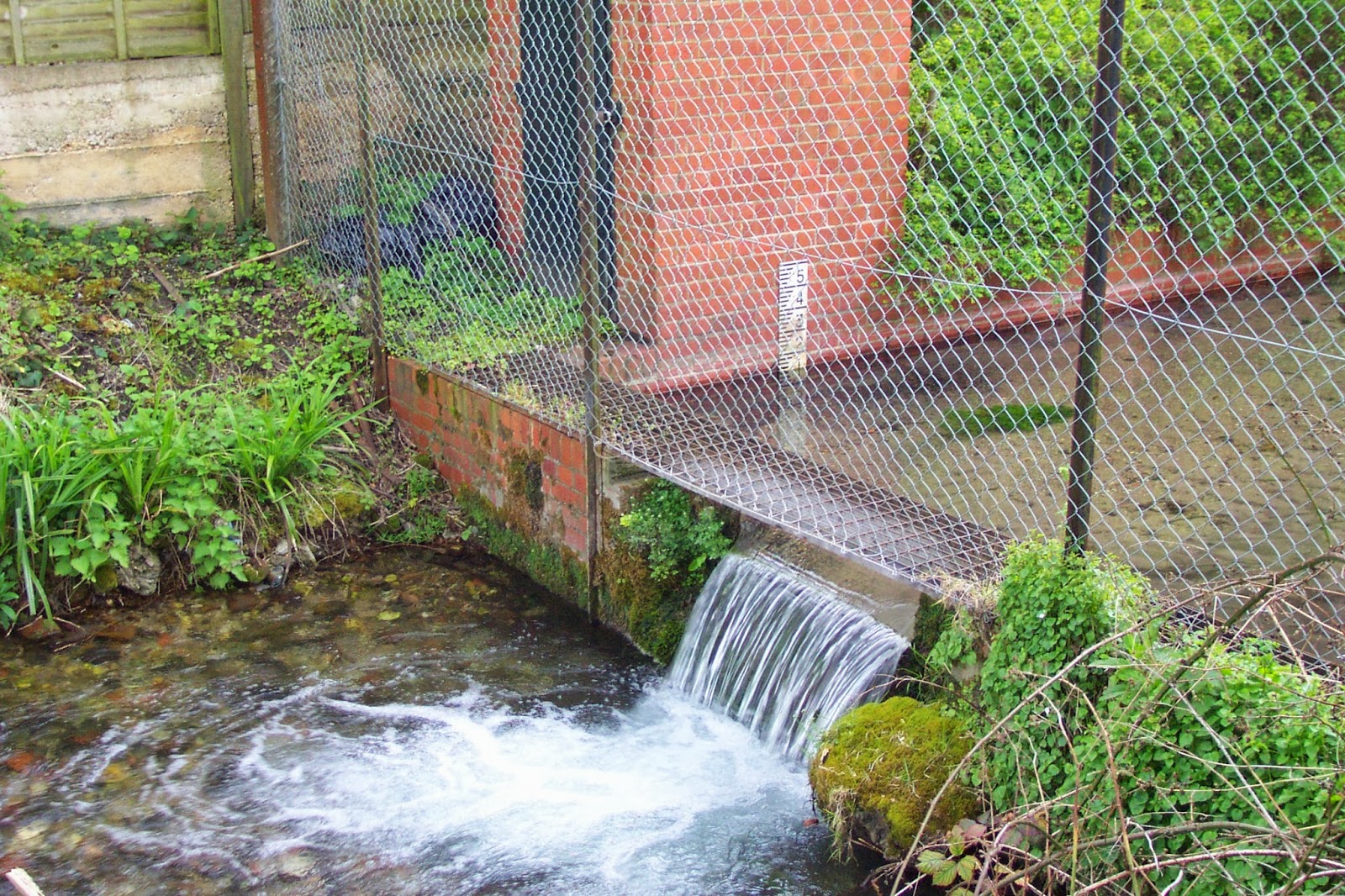
Wendover Springs - thought to be the earliest extant stream flow monitoring
site in the UK. 


The 30th anniversary celebration of the Wallingford move, to be held on 22 October 2013, will review the achievements of the archives and the exploitation of this rich hydrological data resource by a broad user community, which includes regulators such as the Environment Agency, water companies, academic scientists, and environmental and engineering consultancies. The data has also made its way into several scientific papers referred to in the recent IPCC WG1 assessment.

In addition to river flow and groundwater level data, rainfall records and reservoir levels are also held in the archives and the incredible dataset has allowed CEH and BGS scientists to produce a variety of key publications examining both hydrological trends – for example, Are UK floods getting larger? – and the significance of one-off events, such as the 1976 drought. Comparisons between the latest data and the historic record also provide the backbone of the UK's monthly hydrological summary.

Whilst delving through the archives in preparation for this post, I came across this fascinating history of hydrological monitoring before 1985 [PDF], which details how, although Britain has a three centuries-long history of rainfall recording, river flow monitoring only became 'fashionable' after the second world war as industry and government increased their demand for water. The work to establish a national river flow gauging network in the 1950s and 1960s built on a small number of sites that had been established over the previous century, including Wendover Springs in Buckinghamshire - thought to be the earliest extant stream flow monitoring site in the UK.

On the day itself, presenters will look back at how hydrometric monitoring developed in the UK, in response to factors such as the perceived increase in water requirements. They will also examine some of the latest techniques for both monitoring the UK's water cycle, investigate how monitoring and the archive might develop in the future, and tackle the difficult question of what data should we be archiving nationally, given the resource constraints imposed by the current financial situation. In summary, they will take a 'Long View' of a data archive from one of the UK's major environmental monitoring networks, an archive which is particularly important because the UK climate is inherently variable, so short-term tendencies may well not be indicative of long-term trends.

Barnaby Smith

CEH website: Images of gauging stations which have provided some of the oldest records in the archive

Flickr: Album of historic images from the Pynlimon catchments

Additional information


Over the next couple of weeks we will be blogging in more detail about some of the material being presented at the meeting. Further details of the meeting can be found here. Registration is now closed but we will be making much of the content available from this blog and the NRFA pages on the CEH website.

If you're interested in learning more, take a look at the NRFA web pages, where you can find reams of information on how monitoring takes place and how the data is used, and you can also download data for more than 400 of the UK's river flow gauging sites. Information about the records and details of scientific papers which have used the records can be found on the NRFA publications pages.

Wednesday, 1 May 2013

New horizons for CEH research

Research Councils UK, which is the strategic partnership of the UK’s seven research councils (including CEH’s parent body, NERC), opened an office in India in 2008 with the aim of making it easier for the best researchers in the UK and India to develop high impact partnerships in the region.  Last month CEH’s Director, Professor Mark Bailey, and Deputy Director, Professor Alan Jenkins, were able to spend an intensive few days in India with the RCUK India team to explore new opportunities for CEH; these include the possibility of establishing partnerships with high quality Indian researchers in the fields of hydrology and water resource management, ecosystem services and landscape ecology.
Water scarcity is a big problem in India and, along with energy, has been identified as one of the two critical issues that need to be addressed in the country’s current five-year plan. CEH’s expertise in water resources was therefore high on the agenda...

Thursday, 18 October 2012

The future of UK floods and droughts (and the big climate change question)

CEH hydrologist Terry Marsh spent this morning in London briefing members of the press on the facts and figures of UK hydrology throughout 2012. Terry joined staff from the Met Office and the Environment Agency to discuss the transition that has occurred from drought conditions in southern England in early spring, following nearly two years of low rainfall, to one of the wettest periods on record in the last few months.
Terry’s presentation covered the facts and figures of the recent, dramatic hydrological events, putting them into context with the longer term records held within the National Hydrological Monitoring Programme archives at CEH. The discussion at the briefing also touched on the water resources outlook for the winter and 2013, and the longer term question of how the UK should adapt to future changes in flood and drought magnitude and timing.

Floods - are they becoming more common in parts of the UK?


A common question we get asked at CEH is whether floods or droughts are becoming more common in parts of (or all of) the UK. CEH staff regularly publish scientific papers on this subject and a recently published study in the Journal of Hydrology, led by Terry’s colleague at CEH ,Jamie Hannaford, examines the issue in detail.
The new paper, “Trends in seasonal river flow regimes in the UK” (J. Hannaford & G. Buys, Journal of Hydrology), analyses trends over the 1969 – 2008 period in a network of 89 ‘benchmark’ catchments from across the UK. More details can be found in the paper abstract here. The results suggest a much more complex pattern of regional and seasonal variation than revealed in previous work (e.g. two previous papers involving CEH staff published in the International of Journal of Climatology in 2006 and 2008, both of which looked at annual figures from the benchmark catchments as opposed to the seasonal statistics examined in the new paper).
Key conclusions from the new paper include:
·         Some findings resonate with observed rainfall changes, and also with potential future climate change – e.g. increased runoff and high flows in winter and autumn, and decreased flows in spring (but NB. the latter is a result which is sensitive to study period, and is not observed in longer records)
·         In summer, there is no compelling evidence for a decrease in overall runoff or low flows, which is contrary to trajectories of most future projections
The paper abstract concludes:
“Overall, the results do not suggest immediate concern for current water resource management on the basis of observed trends alone: however, the differences between observations and model projections suggest these findings should not be viewed complacently, and greater reconciliation between dataand modelbased assessments should be sought as a basis for informing water management decisions.“
As many have found in the global temperature debate the time series you study has important implications for the conclusions you draw. The Journal of Hydrology paper examined datasets up to the end of 2008 (the scientific paper production process can take a while). Since then we’ve had a sequence of wet summers and drier winters and the CEH team are continuing to work on analysing the latest data, and improving our models, so that our science is better able to inform policy and management decisions.
Additional information